MONTICELLO ESTATE
Eleuthera Attractions
Welcome to the Bahamas’ most relaxing places
French Leave Beach
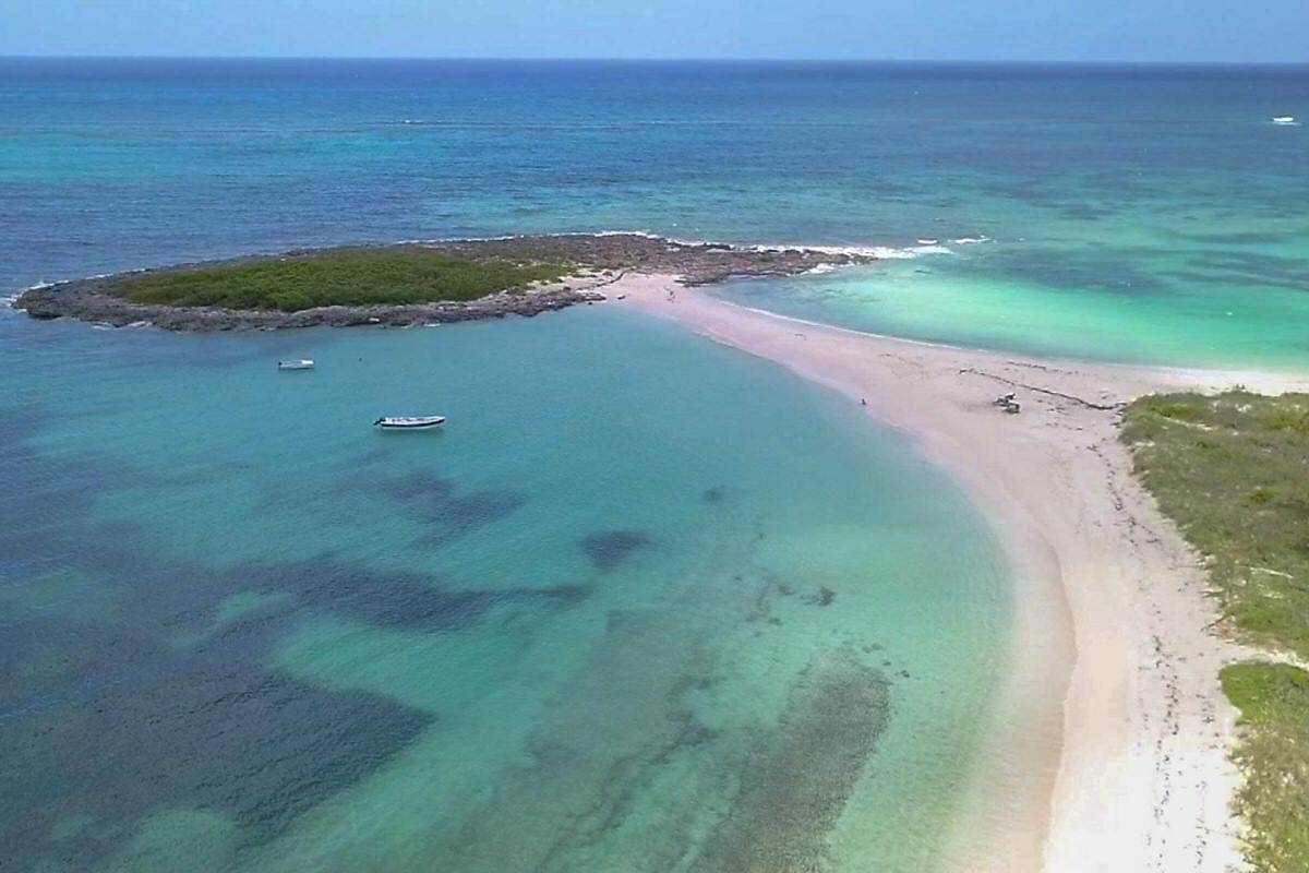
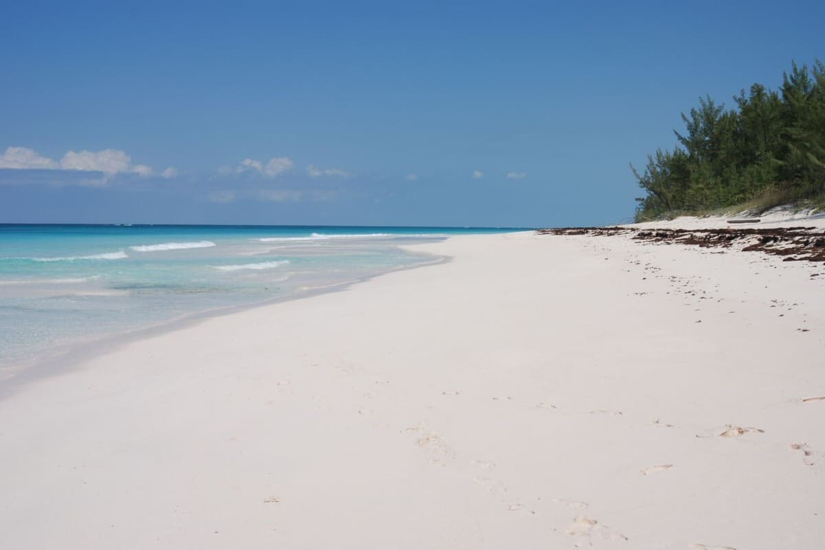
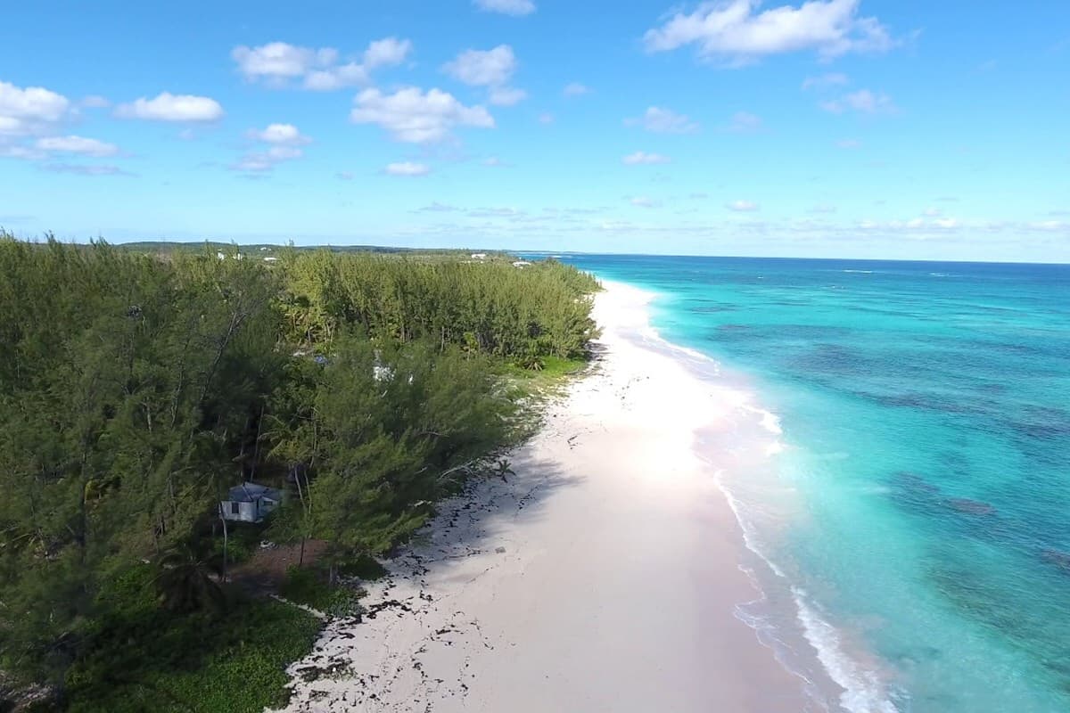
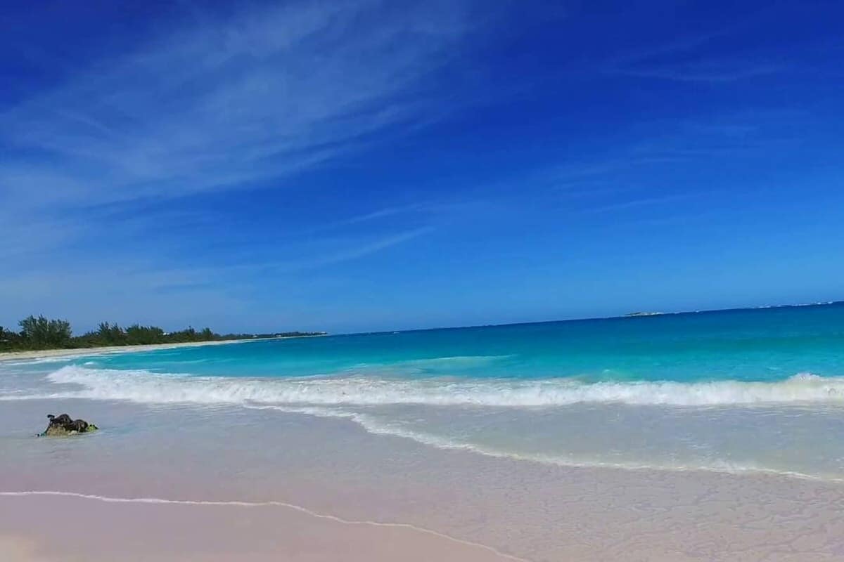
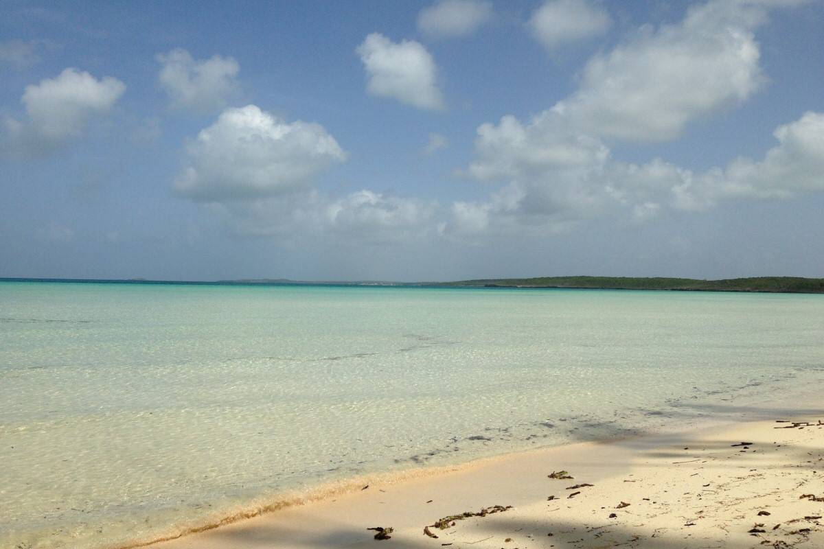
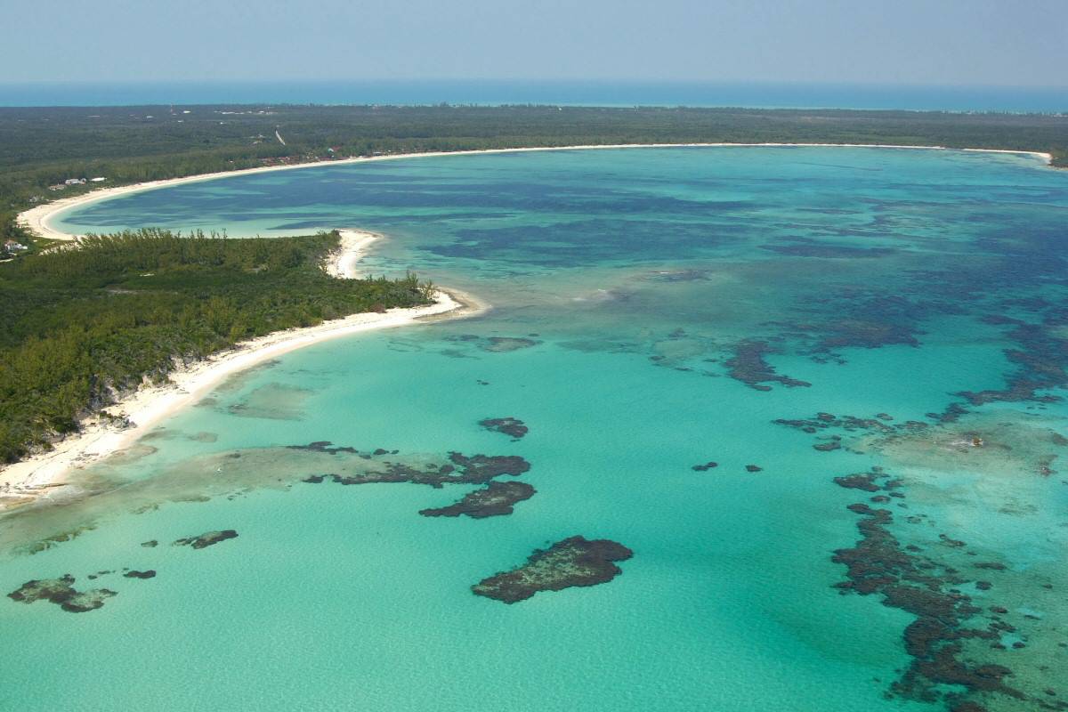
French Leave Beach a.k.a. Club Med Beach is a beautiful pink sand beach that stretches for over a mile. Located on Bank’s Road in Governor’s Harbour, it is one of the nicest beaches on the Atlantic side of Eleuthera and the offshore reefs keep the water mostly calm.
It gets its name from the Old Club Med Resort that was destroyed by hurricane Floyd in 1999; it is now being rebuilt under the name French Leave Resort. This is one of the Eleuthera attractions you don’t want to miss.
- NBeachcombing
- NSnorkeling
- NSwimming
- NSunbathing
- NStargazing
Light House Beach
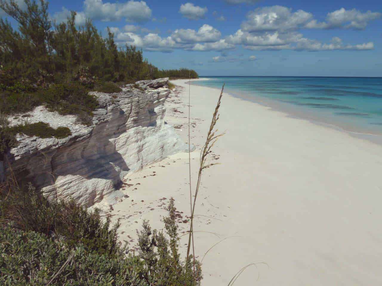
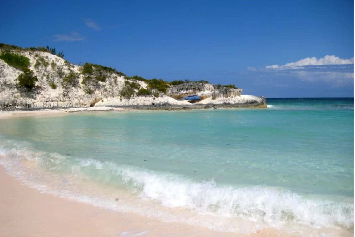
Lighthouse Beach is known for its endless miles of unspoiled, soft, powdery, blush-rose sand beach, considered to be one of the most magnificent beaches in the Islands of The Bahamas, and some say it even rivals Harbour Island’s Pink Sand Beach. This hidden gem teeters at the southernmost point of Eleuthera, on the Atlantic side of the island. It is nestled in the bosom of a massive rock structure behind some sand dunes.
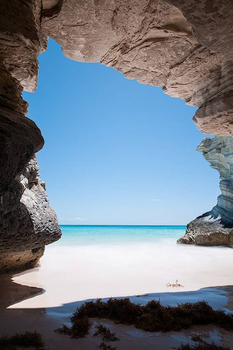
Lighthouse Beach is one of the very unique Eleuthera attractions because you can play in two bodies of water almost simultaneously, the Exuma Sound (Caribbean Sea) and the Atlantic Ocean. The beach on the Caribbean Sea has several hidden caves and offers good shelling and great snorkeling just a walk off the beach.
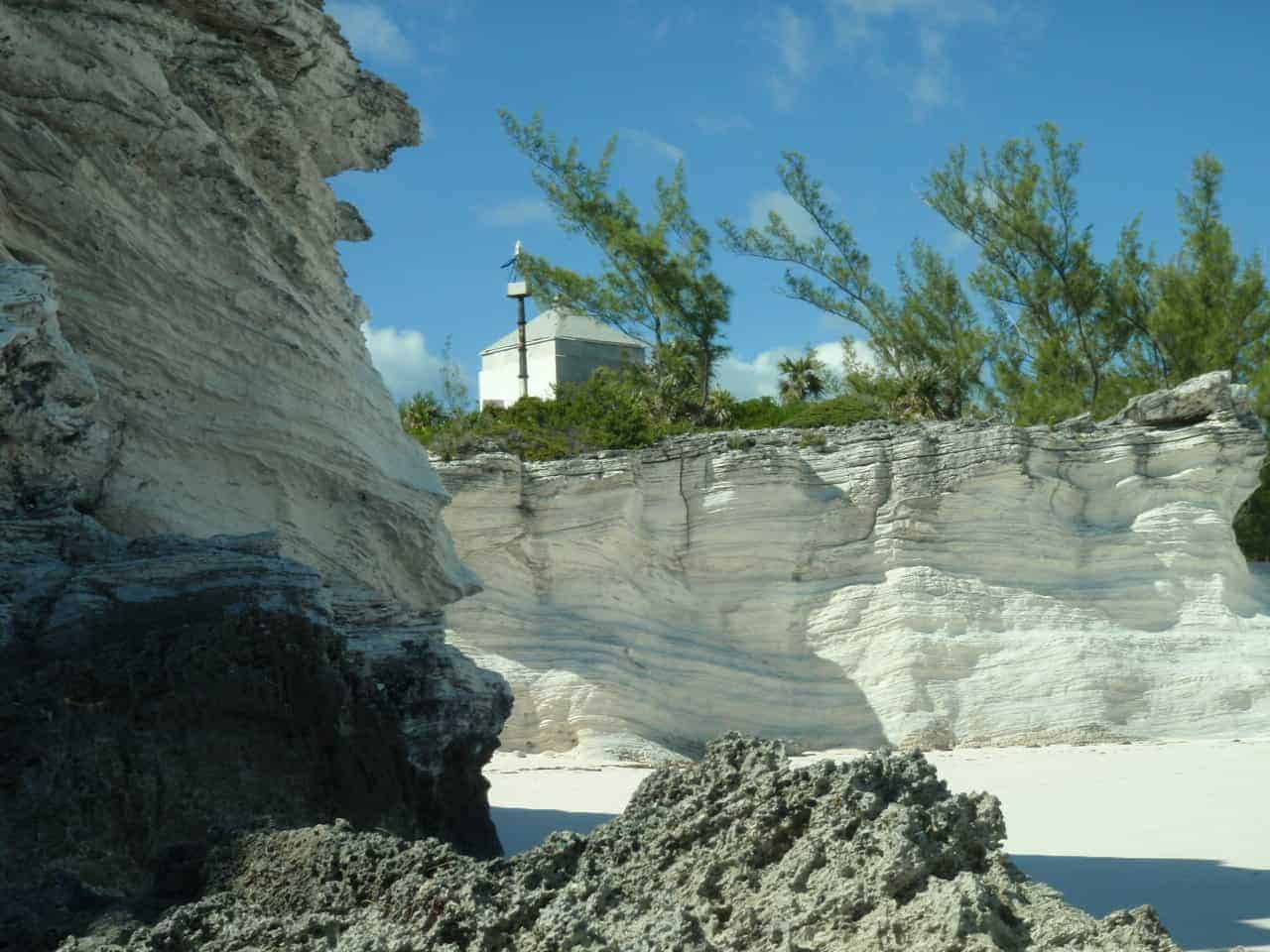
The Atlantic beach offers great vistas, including Half Moon Cay. It is also a great place to sunbathe or pack a picnic basket and spend an entire romantic afternoon or sunset stroll with your significant other. You will have the seclusion of an enclosed cove, as well as the adventure of climbing up to the old lighthouse located on a dramatic limestone promontory overlooking the ocean.
It you want a photo taken in the lighthouse, be sure to stand at the window and it will be naturally framed. If you decide to camp out for the night, the rock structure provides great protection from the elements.
The path to Lighthouse Beach is somewhat difficult, but the payoff is well worth it. One of the best known Eleuthera attractions.
** Note: Disney has purchased this property to create a private cruise ship port for themselves. Soon you will not be able to go here unless on a Disney cruise and it will no longer be pristine and uncrowded. See it now before Disney prohibits access!
Preacher’s Cave
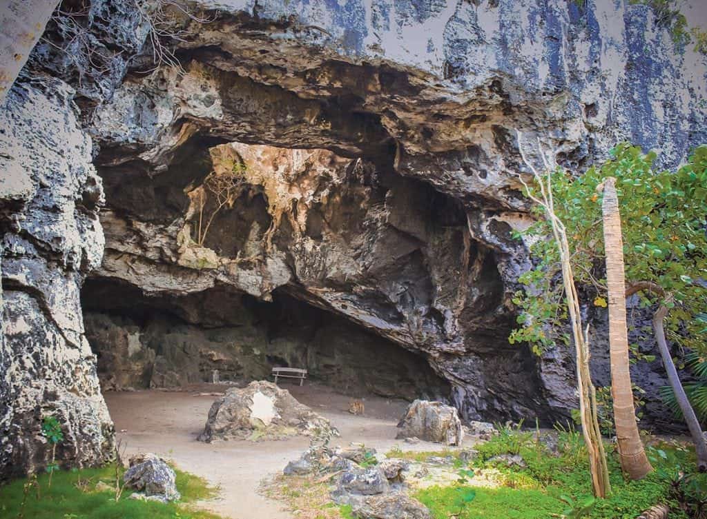
Along with the island of Eleuthera, Preacher’s Cave was discovered in the 1600s by Captain William Sayles. The placard at the entrance of the cave says “William Sayle shipwrecked at Devil Backbone found refuge here. Sermons held 100 years.” The cave is located approximately 10 miles from North Eleuthera Airport and is on the north shores of Eleuthera adjoining a long and broad sweeping beach called Tay Bay Beach.
We can visualize the first discovery of Preacher’s Cave from Everild Young’s book Eleuthera: “One can imagine the two tiny ships feeling their way southward with their cargoes of hopes and aspirations, the sea bright, sparkling in the sunshine, and then all of a sudden producing one of those appalling storms that the islanders today call “a rage”. They must have sailed too close to the reefs bounding the northern tip of Eleuthera on the Atlantic side of the island, and been caught by a sudden change of weather.”
The Glass Window Bridge
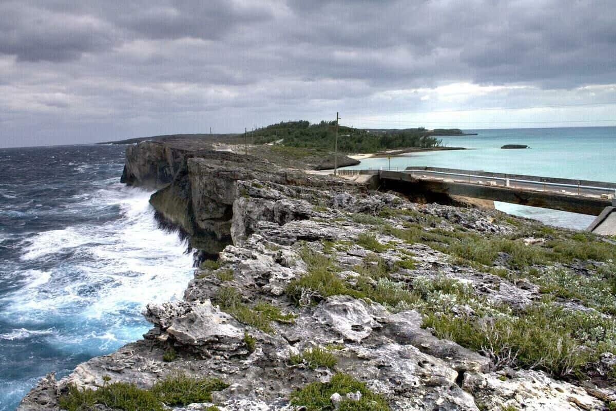
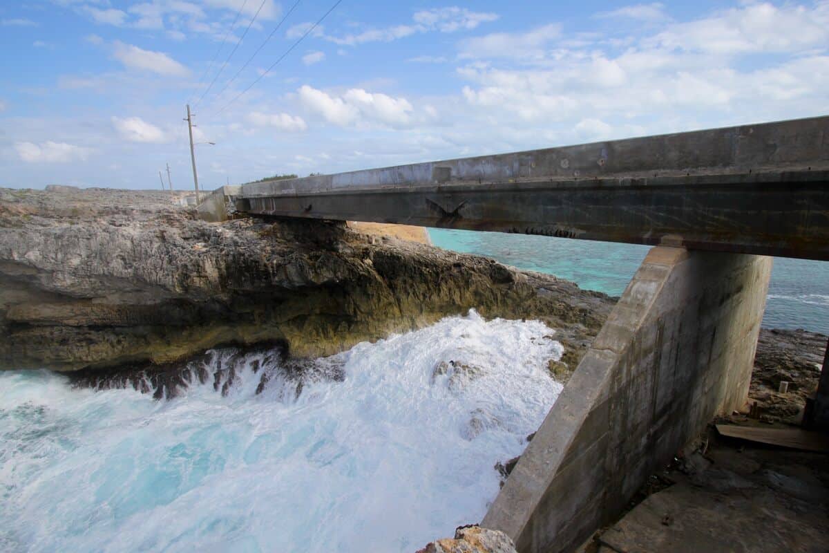
The “Bridge” is about two miles east of Upper Bogue and joins Gregory Town and Lower Bogue at the narrowest point on the island. One of nature’s true wonders, The Glass Window Bridge will certainly leave you breathless as you drink in the magnificent panoramic view. It is one of the few places on earth where you can compare the rich blue waters of the Atlantic Ocean on one side of the road and the calm Bight of Eleuthera (often incorrectly called the Caribbean Sea) on the other side, separated by a strip of rock just 30 feet wide.
The stone arch connecting Eleuthera island’s two narrow strips of land is long gone, washed away by hurricanes. A concrete bridge has taken it’s place. But the name given to the unique site has stuck. Often called the “Narrowest Place on Earth”, the bridge today still provides a view of the stunning contrast between the Atlantic and Bight of Eleuthera’s distinct natures. Occasionally, when a strong wave washes over the rocks, for a brief moment that separation disappears, and the two bodies of water shake hands. One of the Eleuthera attractions not to be missed.
Ocean Hole
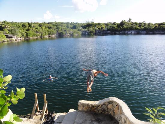
Ocean Hole is a large, circular, inland blue hole located in Rock Sound, Eleuthera, Bahamas. Approximately one mile from the ocean, it is one of Eleuthera’s most famous landmarks, teeming with several different types of fish that was stocked many years ago by fisherman. Locals believe that this mystical body of water is bottomless and has healing powers. The hole was once explored by Jacque Cousteau, a former winter resident of Eleuthera. In the mid-1950’s to early 1970’s it was a well-established park that was used by both locals and visitors alike.
The main part of Ocean Hole averages about 90 feet deep. However, at the southwest corner (a compass bearing of 211 degrees from the main deck beneath the staircase) lies the legendary “bottomless” part of the Ocean Hole which has been verified by tracking dye to be a very deep tunnel to the ocean (as with most ocean holes on Eleuthera, sufficiently deep that no fish ocean fish pass under to the ocean hole).
As recently as 2004, the Ocean Hole was relatively clear, and features on the bottom could be seen from the surface thanks to the water-cleaning parrotfish that lived within. However, when the area was improved by adding the park, pruned branches were allowed to fall into the hole, the sap from which altered the chemistry of the water enough to kill off the parrotfish. Until the parrotfish are restocked, the top part of Ocean Hole remains green and opaque, making for very dark, low-visibility diving.
Ocean Hole is not only one of the Eleuthera attractions, it has been a source of recreation and education for locals and visitors for a long time. Teachers occasionally take their students here on field trips as a part of learning about history and science as well as for recreational activities. The Park is sometimes used for community events such as Junkanoo Summer which was held in August of this year. Residents and visitors frequent the hole to feed the fish, dive off of its cliffs and/or take in its beauty while dipping their feet in its waters.
Queens Bath
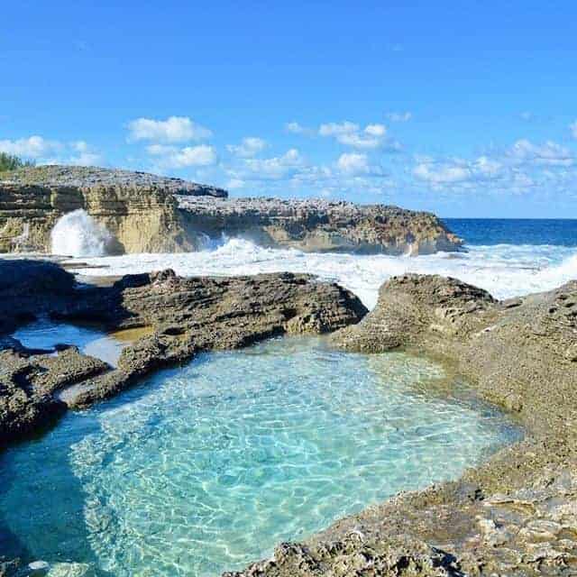
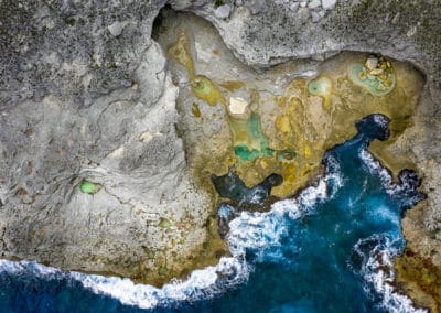
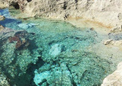
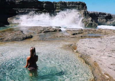
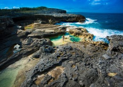
Queens Bath, also known as the Hot Tubs, is a set of natural pools located just over half a mile south of Glass Window Bridge on the Atlantic side of the island. These natural pools were formed by centuries of waves crashing and eroding away at the rock. During high tide, waves crash over the rocks filling the pools with water and small sea life. During low tide, the sun warms up the water in these pools making them as warm as bath water.
The best time to explore Queens Bath in Eleuthera is during low tide. You can crawl around on the rocks and wade in the pools while you watch the waves of the Atlantic Ocean. You are also able to observe aquatic wildlife up close in the pools. The tides bring in a variety of sea life including sea urchins and small fish. There is no designated path leading down to the pools, so younger children may need help getting down to the rocks.
Make sure to wear water shoes or tennis shoes when you visit the rocks, as they can be sharp. The access point is located off of Queen’s Highway. The well-marked stone entrance is just south of the Glass Window Bridge.
If the sea is calm, enjoy a dip during low to medium tide. But do not go down to sea level at high tide. If the sea is not calm…do not go to the Baths…people have been swept away in tragic accidents.
CATHEDRAL CAVE (SPIDER CAVE)
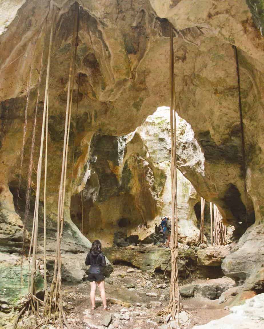
This small but impressive cave is located behind the ocean hole across the Queen’s Highway from the African Methodist Church just south of Rock Sound. The short rock-lined trail to the cave goes around the left (south) side of the ocean hole, then continues beyond it to a slanted wooden ladder. This cave is a karst formation not unlike Preacher’s Cave, and thus lacks speleothems.
The cave itself is fairly short, but the roots cascading down from the trees on top of the cave, along with the majestic rays of light cast through the ceiling on a sunny day are quite breathtaking. If you liked Preacher’s Cave, you’re certain to love this cave as well.
A little hard to find, it’s worth the walk. It seems obvious from the name, but there are spiders here. Really big ones. Like the size of a dinner plate big. If that is not your thing, don’t go. If you aren’t completely creeped out by the idea of a spider as big as your hand, then it is cool cave to explore.
It is basically two large chambers, open to the sky in several places, so no issues with claustrophobia here. It does require climbing down a ladder and over a few boulders, so probably not one of the best Eleuthera attractions for very small children, but our school age kids did fine.
BEACHES
With more than 130 beaches on the island, you won’t have any trouble finding a secluded, beautiful beach to while away the day, pick up shells, do some snorkeling or spot some sea life. here’s a list of our top beaches (from North to South).
North Eleuthera Attractions
Ben Bay Beach
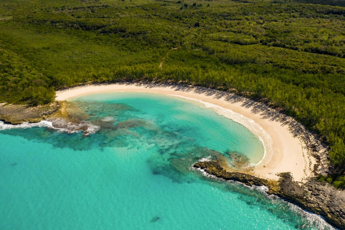
Horseshoe-shaped Ben Bay beach simply couldn’t be more perfect. The narrow opening to the bay provides a lot of protection for the beach and even when the Atlantic is rough, the water in the bay stays calm.
The swimming here is great. The water is clear and calm and the bottom of Ten Bay beach is sandy and even.
Be sure to bring your snorkel gear along. You can stay inside the bay and snorkel the rocky areas that protect Ben Bay beach.
Directions: From North Eleuthera airport, drive West for 1.5 miles. At the large gas station turn right and go North in the direction of Spanish Wells. After 6 miles there is a sharp, 90 degree bend to the left. About 0.1 miles past it, take the first dirt road to the right. Continue for 0.2 miles.
(Although the dirt road is flat and even, it’s overgrown in several places. There are fields growing fruits that are someone’s livelihood. No sampling! Please respect this.)
Then turn left at the fork. Continue for 0.3 miles and turn right at the fork (even though the road to the left looks like a better road). Continue for half a mile and turn left at the fork. Stay on this pretty overgrown road for about two minutes and park your car in the shade of the casuarina trees on the beach.
Tay Bay Beach
Tay Bay Beach is just a few steps away from Preacher’s Cave, a famous tourist attraction of Eleuthera.
There are treacherous waters near this beach. Because of the hidden underwater rock formation called The Devil’s Backbone, the first settlers shipwrecked and took shelter in the cave.
Directions: From North-Eleuthera airport drive west for 1.5 miles. At the large Texaco petrol station turn right and go north in the direction of Spanish Wells. After 6 miles there is a sharp, 90 degree bend to the left. Do not use it but turn right into the dirt road at this kind of T-junction and continue straight on for 1.7 miles to another dirt road to your left. There is a tiny, easy to miss, sign that reads “Preacher’s Cave” and “Beach”. Follow this dirt road for 0.25 miles. At the end, the sandy path to your right opens into the beach; the grassy path to your left goes to Preacher’s Cave.
North Central Eleuthera Attractions
Gaulding Cay Beach
There are a few homes nearby. But in the shaded area right behind Gaulding Cay beach, you’ll be feeling as if you were on your own private beach. It’s quite apart from the nearby homes.
This is a great place to come for a picnic and a day of swimming, snorkeling and relaxing. The sand is soft, smooth and powdery and the water between the beach and the little island is so shallow that you can even walk out to it at low tide.
You’ll find good snorkeling around the rocky areas and around the large rock out in the water.
And if you are looking for a nearby restaurant, there’s a pleasant one across the main road as you enter the sand road to Gaulding Cay beach. Located in a white & yellow building, Daddy Joe’s serves lunch & dinner in a nicely decorated A/C room. They have a cool bar, too.
Directions Coming from North Eleuthera:
Go past Glass Window bridge. Continue for 1.1 miles. You will see two yellow & white apartment buildings on the left. In one of them is a nice restaurant, Daddy Joe’s. The road entrance to the beach is on your right. (See further direction below)
Directions Coming from Central Eleuthera:
Take a mileage reading at the ISLAND MADE GIFT SHOP in the center of Gregory Town. It’s a white building on your left with pink shutters. Continue for another 3.4 miles. You will see two yellow & white apartment buildings next to each other. In one of them is a nice restaurant, Daddy Joe’s. The road entrance to the beach is just across from the restaurant.
Having left the highway, go 0.2 miles to the beach, keeping right at the “Y” in the road and continue straight on to the beach. With reasonable care Gaulding Cay Beach can be accessed by any car along that sandy road.
Surfer’s Beach
Unless you are a strong swimmer we suggest you confine your swimming to the small cove at the north end of the beach. It’s to the left of the beach shack that surfers have built using driftwood.
There’s an interesting huge rock formation that you’ll see after walking up north for a minute or so. And there’s natural shading, too, where you can rest and watch the sea.
The small cove at the north end of the beach is good for snorkeling on very calm days. Other than that, this beach is not recommended for snorkeling.
Directions Coming from the North:
From Gregory Town: 2.0 miles south of Pam’s Island Made Gift Shop turn left at the large sign that says “Surfer’s Beach Manor”. Follow the rocky road to Surfer’s Beach Manor. At the bottom of the hill is a T-junction. Turn left. The next road on your right – a sandy road – is the access road to the beach.
Make sure your car has good clearance. Although a 4WD vehicle is not necessary, adequate clearance and caution is. You could also park at Surfer’s Beach Manor and walk.
Directions Coming from the South:
From the Rainbow Inn: 5.9 miles north of the Rainbow Inn turn right at the large sign that says “Surfer’s Beach Manor”. Follow the rocky road to Surfer’s Beach Manor. At the bottom of the hill is a T-junction. Turn left. The next road on your right – a sandy road – is the access road to the beach.
Make sure your car has good clearance. Although a 4WD vehicle is not necessary, adequate clearance and caution is. You could also park at Surfer’s Beach Manor and walk.
Rainbow Bay Beach
Between Gregory Town and Governor’s Harbour airport, Rainbow Bay is probably one of the most frequently visited beaches in the area. Homeowners in Rainbow like to come here, so don’t expect any privacy.
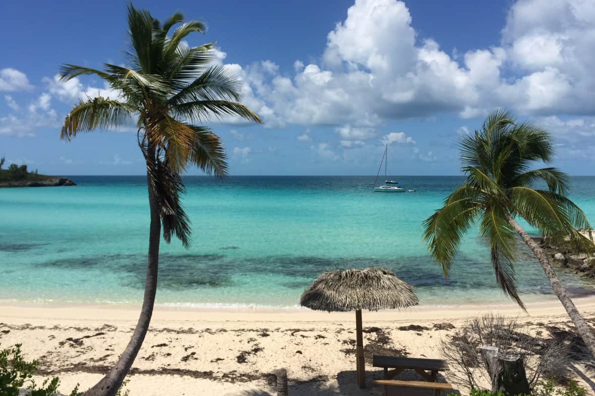
Rainbow Bay is easily accessible and a good example of a Caribbean beach with clean, clear turquoise water that is calm and warm. Stop by this beach to swim, snorkel and just relax. This is a great swimming area. It has a clean, white sand bottom and is shallow for a long way out. The water is always calm and welcoming. There is some good snorkeling around the larger rocks in the water and along the low cliffs.
This is one of the easiest beaches to get to. Particularly recommended when the sea is too rough on the Atlantic side which is the other side of Eleuthera. On the left side of the sandy beach there is a rocky area too where snorkeling is great. Put this beach on your list of Eleuthera attractions to visit.
Directions Coming from the North:
One mile after Rainbow Inn, the two-story octagonal restaurant to your right, turn right into Wandering Shore Drive and continue for a quarter mile to the Rainbow Bay Park Site parking area.
Directions Coming from the South:
After having passed through the settlement James Cistern, you’ll notice a restaurant and store out in the country side to your right.
It’s named Big Rock and the sign saying so may be missing. But you will recognize it by the large, unpaved parking to the right of the road.
Two miles after it, turn left into Pirate Lane and then immediately left again into Wandering Shore Drive and continue for a quarter mile to the Park Site parking area.
Rainbow Bay is an easy-access beach with paved road right to the beach and a designated parking area.
Airport Beach
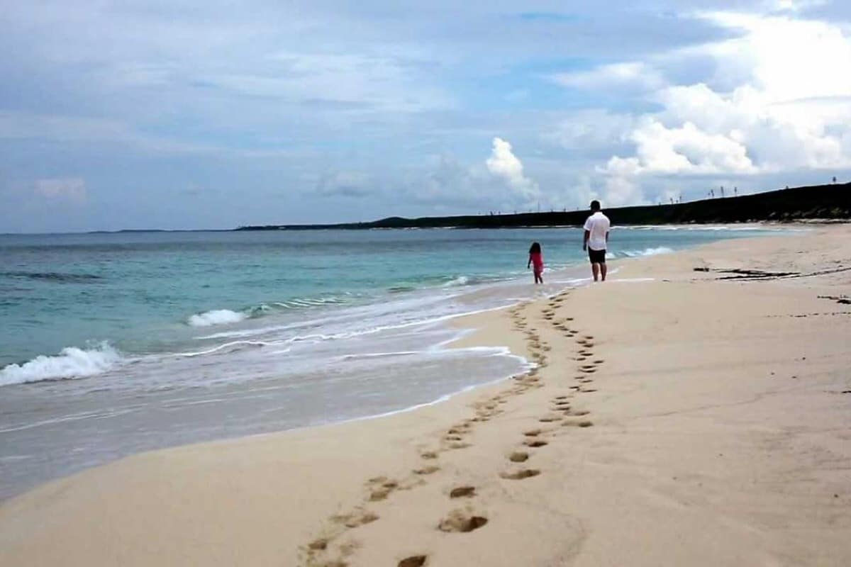
You can walk three barefoot miles along Airport Beach. Yes, airport beach is that long. It’s also called Navy Beach because the U.S. Navy had a base there. We like to take extended strolls, sandals in hand and feet in the water for most of the walk. The sand is fine, pink and firm, making it great for long, leisurely strolls. And if you start out at the south end you will have six miles to walk all the way to the end and back.
Swimming in the southern part is good, as the beach remains fairly shallow close to shore but remember, it’s the Atlantic side and there can be some pretty good waves from time to time.
Swimming in the central part. It is relatively calm here but there can be waves that knock you to the ground. Not a pleasant feeling…
In the northern part, swim with caution. There are steep drop offs and a strong undertow.
Directions Coming from the North:
There’s only one paved access road to airport beach, actually to the southern-most part. Here is how you’ll find it. Coming from the North: 2.2 miles south of Governors Harbour airport you’ll see some orange poles and a thick orange rope. Turn left onto the paved Knowles Drive and proceed for 0.4 miles. Park your car at the right turn and walk the last few yards to the beach. Turn left to walk the three miles to the North.
Directions Coming from the South:
There’s only one paved access road to airport beach, actually to the southern-most part. Here is how you’ll find it. Coming from the South: 5.8 miles north of the gas station in Governor’s Harbour, you’ll see heavy orange poles and a thick orange rope. Turn right onto the paved Knowles Drive and proceed for 0.4 miles. Park your car at the right turn and walk the last few yards to the beach. Turn left to walk the three miles to the North.
Central Eleuthera Attractions
Alabaster Bay or Receiver’s Beach
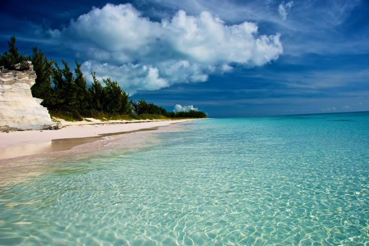
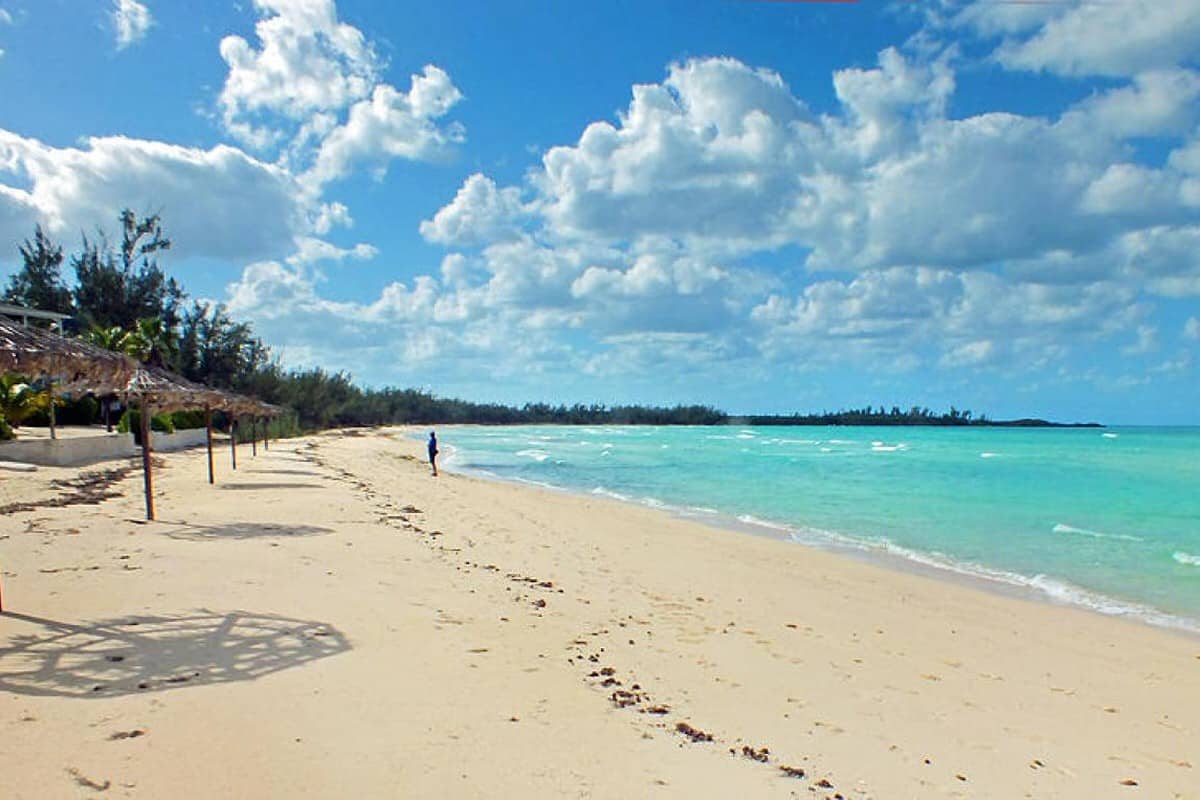
The shallow sea at Alabaster Bay is calm most of the time. The beach has powdery white sand and crystal clear water. Also known as Receiver’s Beach, the beach is a wonderful place for relaxation. If you drive down the road, you can see the remnants of buildings that were once part of the US Navy Base on Eleuthera. The water is very shallow and there is no undertow. The beach is more than a mile long and you can find gorgeous sand dollars and star fish.
Directions Coming from the North:
One mile south of Governor’s Harbour airport you’ll see to your right, four buildings in bright colors, yellow, green, red and blue. Turn right at the paved road where a sign says Cocodimama Charming Resort.
Proceed for 0.1 miles on the paved road right to the sandy beach of where you can park your car in the shade of the casuarina trees.
Directions Coming from the South:
6.8 miles north of the Shell station in Governor’s Harbour, turn left at the paved road. Proceed for 0.1 miles on that road right to the beach where you can park your car in the shade of the casuarina trees.
Twin Coves Beach
Twin Cove Beach is two secluded beaches near central Eleuthera. The beaches are on the Atlantic side of the ocean and the calm, warm waters are perfect for swimming and snorkeling and you will often see sea turtles, stingrays, parrot fish, and small sharks swimming around the colorful brain coral and fan coral.
The beautiful Twin Coves are lined with mature palm trees. You are sure have a good time snorkeling at the far right side which is a rocky area. But do also snorkel around the little island or in the area to the far left of Twin Cove beach where the water is crystal clear. Remember that this is the Atlantic side. Pick a calm day.
Directions Coming from the North:
Coming from the North: 6.5 miles south of Governors Harbour airport, you’ll see a large and new white building trimmed in blue called Workers House. Right after it, turn left into the road going up the hill.
Directions Coming from the South:
From the gas station in Governors Harbour, drive north for 1.6 miles. Turn right into the road going up the hill just before the Workers House. Continue up to the top of the hill. Cross a paved road and after a few yards go left at the fork and then downhill. Turn right at the T downhill. Continue for 0.3 miles on a sand road. In a coconut grove there’s a house to your left. At the end of the garden turn left and walk the last few steps to the beach.
Club Med / French Leave Beach
Named for the Club Med that was destroyed by Hurricane Floyd, most people now call this French Leave Beach. One of the most beautiful beaches in the world, it is miles of pink sand, gorgeous blue water and swaying casaurina and palm trees. This is a must-see beach. This is a popular beach, so you may find 5 or 6 other people on this one!
This is as nice as a beach can get and one of our favorite Eleuthera attractions.
Directions from Governor’s Harbour:
In Governor’s Harbour, you’ll see the small pink building across from the harbour (everyone calls this “the intersection” Just to the north of the pink building, turn onto the road going up the hill. At the top of the hill, turn right. Continue down hill. After 1 mile from the hill top, the beach access path is to your left. You could also go straight through the intersection at the top of the hill and turn left at the fork in the road. Keep working your way to the right and you will find the sandy beach roads with many access points.
Poponi Beach
Just like Club Med beach in Governor’s Harbour, Poponi Beach is on the Atlantic side. It has lots of trees, so there’s shade when you need it.
The water remains fairly calm. Go ahead, jump in and enjoy a swim. The turquoise and blue colors of the shallow water are spectacular. And bring your snorkel gear. Check out the rocky areas but be sure to do your snorkeling on a calm day.
We like Poponi in North Palmetto Point for long walks, up to 4 miles until we reach Club Med Beach, across from Governor’s Harbour.
Directions from Palmetto Point:
At the intersection in Palmetto Point, turn east onto Church street. This is the main intersection right in between Palmetto Point North and Palmetto Point South. You will notice a store on either side of the main road.
Proceed for 0.8 miles to a T-junction. There’s a huge silk cotton tree (photo to the right). Turn right and go 0.3 miles. Then turn left onto a dirt road that goes uphill. Continue on that dirt road for 0.1 miles to a small parking area at the beach.
Double Bay Beach
Located towards the middle of the island and only seven miles from the capital of Eleuthera, Governor’s Harbour, Double Bay Beach on the Atlantic side has your name written all over it especially if you would enjoy a largely deserted 2 mile long stretch of sand that you can walk to your heart’s content. Because all the homes are private and the only public access is at it’s extreme southern end, the only folks you’ll run into on your strolls are other renters or owners.
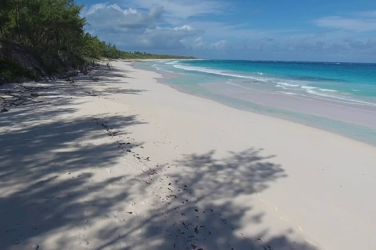
The beach is long and straight for the most part with just one rocky section as the beach turns generally towards the north. Wide, pink sand beach with gorgeous blue water. There’s snorkeling at the far ends. When the conditions are calm the water entry is easy with sand so soft you might think that it’s powdered sugar.
Good snorkeling can be found along the rock ledges on the south end of the beach and there is even an old shipwreck or two that you can look for. Shade is provided by tall palm trees, but you’ll probably want to have an umbrella with you on this beach especially if you want to dip your toes into the ocean.
Travelers who want a more upscale experience will love the houses on Double Bay as they tend to be larger with a lot of private acreage. You’ll often have so much privacy that you think you’re on your own island.
Directions from Governor’s Harbour:
8.4 miles south of the gas station in Governor’s Harbour (or 3.1 miles from the gas station in Savannah Sound if coming from the south), turn left (or right if coming from the south) onto a paved road. There are columns on either side of the road.
Continue on this paved road – a narrow causeway with inland ponds on either side – for one mile to a gravel road. Turn right at the T and proceed for approximately one mile.
Then take the sand road to your left and go for 0.1 miles directly to the beach where you can park your car in the shade.
Ten Bay Beach
Full disclosure–this is our very favorite beach on the entire island. We’ve spent so many days here floating in the beautiful water, drinking a beer, finding starfish, sand dollars and seeing dolphins, bonefish and the occasional barracuda. At low tide, you can wade more than 200 yards and still be only waist deep. This is a popular beach so you probably will encounter a few other people.
This beach is also terrific for kids…shallow, calm and very sandy.
Directions from Palmetto Point:
3.7 miles south of the Palmetto Point crossroads you’ll see a blue and yellow government metal sign to your right that says Beach Access. Turn right into the dirt road and proceed for 0.4 miles on that track to the beach parking. The road is in pretty good shape. Any car can negotiate it.
If you’re coming from the south, 2.6 miles after the gas station in Savannah Sound, you’ll find the blue and yellow government metal sign to your left that says Beach Access. Turn left into the dirt road and proceed for 0.4 miles on that track to the beach parking.
South Eleuthera Attractions
Winding Bay Beach
Winding Bay Beach is nestled between Rock Sound and Tarpum Bay. Unlike many beaches in the Bahamas, Winding Bay Beach is known for being empty, making it a peaceful place to plan a day trip or a beach day. It’s most ideal for a stroll along the uniquely hued pink sands, taking in the sights and ambiance of Eleuthera.
Winding Bay Beach is known to have a lot of seaweed, meaning that you should not choose this beach as a snorkeling or scuba diving destination during your vacation.
However, the waters here are calm, and clear closer to the shoreline. Because of the clear nature of the water at Winding Bay Beach, many visitors remark on being able to see an abundance of Hawksbill turtles, just offshore.
During some seasons of the year, starfish can also be seen on this beach. Additionally, Winding Bay Beach is home to stingrays and black tip sharks—small sharks that average about 2-3 feet in length. In short, there are a variety of marine animals, which can make for fascinating snorkeling, but exercise caution while swimming around wildlife.
Directions Coming from the North:
About a mile south of the Tarpum Bay intersection, turn left at the gas station onto a paved road and continue for 1.9 miles to an easily visible beach access path to your left. This trail is about 150 yards long. Park your car in the shade and walk the last few steps to Winding Bay beach. The south side is to your right. That’s probably the part you’ll want to see first.
Directions Coming from the South:
Coming from the South, 6.7 miles north of Rock Sound Hardware – which is part of a shopping center on the left of the highway – turn right into a paved road at the gas station.Continue for 1.9 miles to an easily visible beach access path to your left.
Whiteland Beach
This romantic and secluded beach is located on the Atlantic side of the island, about four miles south of Rock Sound settlement. The beach area is reef protected, and after walking into the water, you will discover it has an even, sandy bottom and many natural tiny coves to swim around in. There is plenty of shade and it’s a perfect place to unwind and relax after having a picnic lunch with family or friends.
This beach is famous for the hole in the rock called Blue Window. The fact that there are plenty of places to eat along the shore is a good reason why the beach is one of the favorite Eleuthera attractions.
Directions Coming from Rock Sound:
0.7 miles south of “The Market Place”, a shopping center in Rock Sound, to your right, as you drive into town from the north, turn left onto Fish Street. Continue for 1.5 miles on a paved road until you reach a T-junction. Take a mileage reading. Turn right onto a gravel road that can be handled by any car. Continue through the bush on a flat dirt road for 2.5 miles. Make a left and go .2 miles. Go left and you’ll find some parking and beach access.
Lighthouse Beach
Lighthouse Beach is known for its endless miles of unspoiled, soft, powdery, blush-rose sand beach, considered to be one of the most magnificent beaches in the Islands of The Bahamas, and some say it even rivals Harbour Island’s Pink Sand Beach. This hidden gem teeters at the southernmost point of Eleuthera, on the Atlantic side of the island. It is nestled in the bosom of a massive rock structure behind some sand dunes.
Lighthouse Beach is very unique because you can play in two bodies of water almost simultaneously, the Exuma Sound (Caribbean Sea) and the Atlantic Ocean. The beach on the Caribbean Sea has several hidden caves and offers good shelling and great snorkeling just a walk off the beach. One of the great Eleuthera attractions.
The Atlantic beach offers great vistas, including Half Moon Cay. It is also a great place to sunbathe or pack a picnic basket and spend an entire romantic afternoon or sunset stroll with your significant other. You will have the seclusion of an enclosed cove, as well as the adventure of climbing up to the old lighthouse located on a dramatic limestone promontory overlooking the ocean.
It you want a photo taken in the lighthouse, be sure to stand at the window and it will be naturally framed. If you decide to camp out for the night, the rock structure provides great protection from the elements.
The path to Lighthouse Beach is somewhat difficult, but the payoff is well worth it.
** Note: Disney has purchased this property to create a private cruise ship port for themselves. Soon you will not be able to go here unless on a Disney cruise and it will no longer be pristine and uncrowded. See it now before Disney prohibits access!
Directions Coming from Rock Sound:
7.3 miles south of Rock Sound Hardware – the large shopping center with an Esso station – turn left at the road with “Cotton Bay Club” signs on either side. The road is paved but has many potholes. After 3.5 miles, turn left at the cross roads and continue on a good road for 8 miles. On your right you’ll see the Bannerman Town sign. The highway takes a 90 degree bend to the right. The beach access road goes straight through. After 3.3 miles you’ll see Lighthouse Bay to the right. Park the car at the end of the road and walk over the sand dunes to your left to get to Lighthouse Beach.
WHAT ARE YOU WAITING FOR?

We are a family of four and we live in the United States. Our passion for the Island of Eleuthera started in 2003 when we first went there on vacation.
We went back the year after as we really loved those pink sand beaches and the friendly local people.
Quick Links
Availability / Booking
Call Us
+1-713-409-3035
Email Us
Our Location
Vacation Rentals Eleuthera Island
Governor’s Harbour
North Palmetto Point
Eleuthera Bahamas


